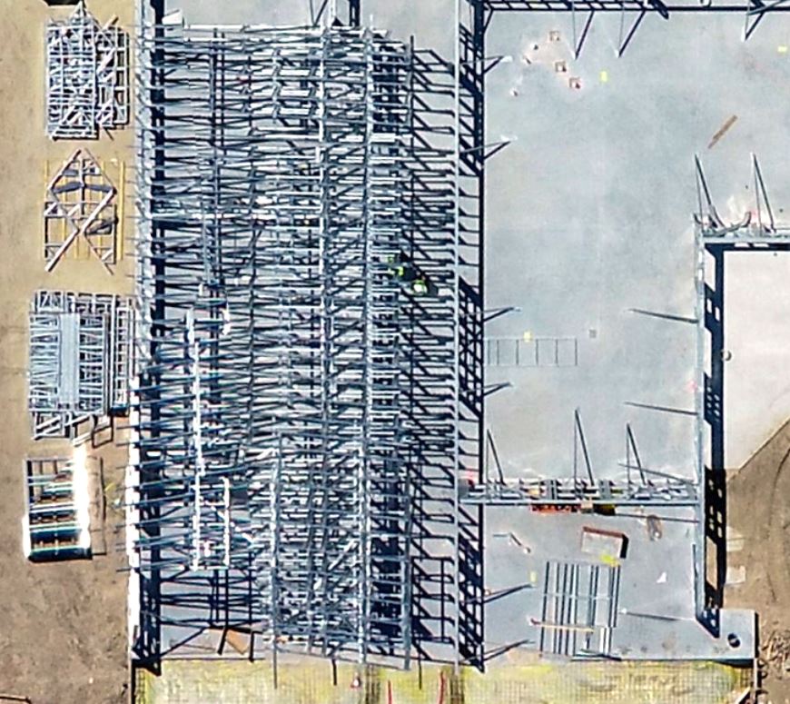
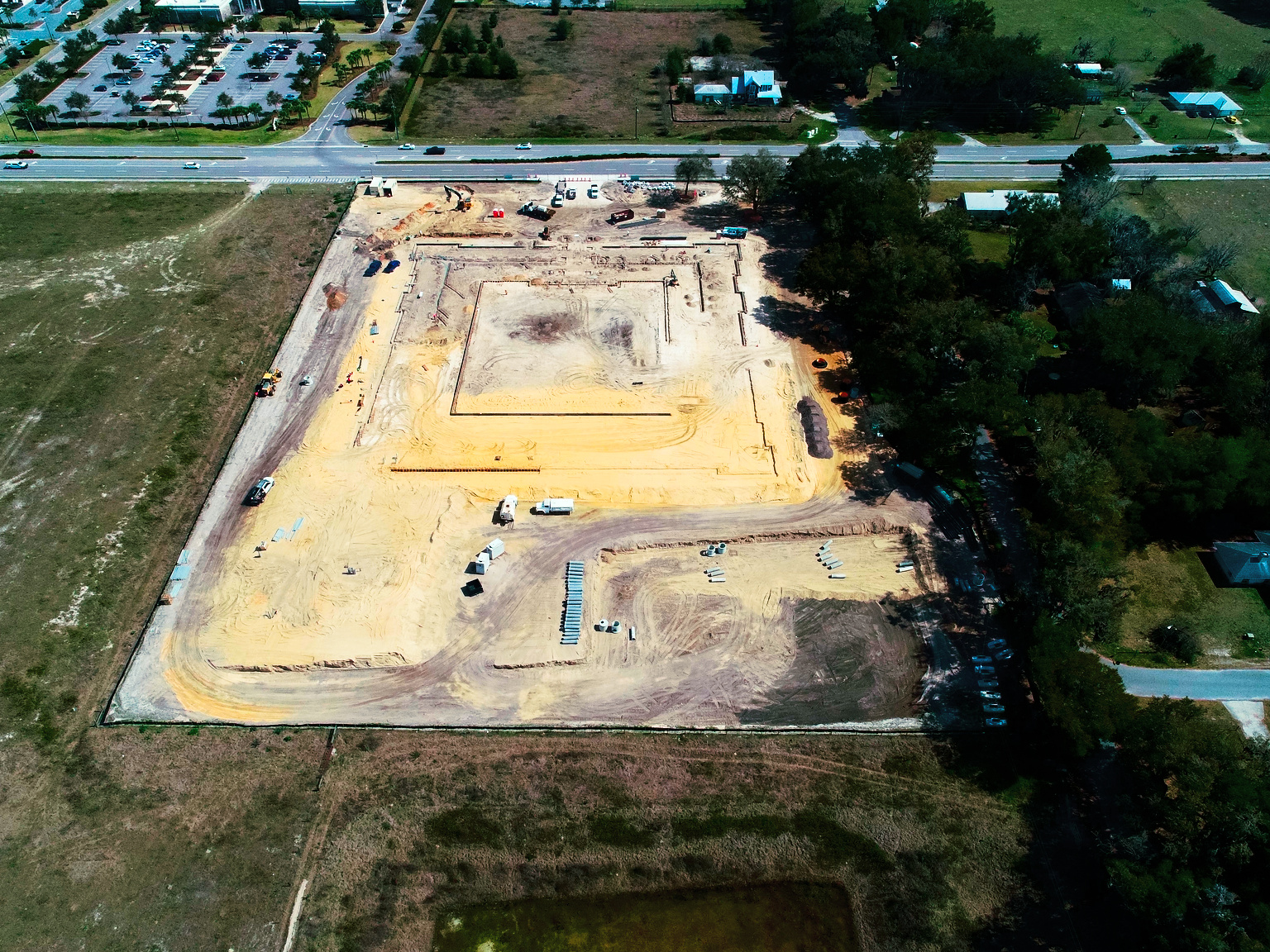
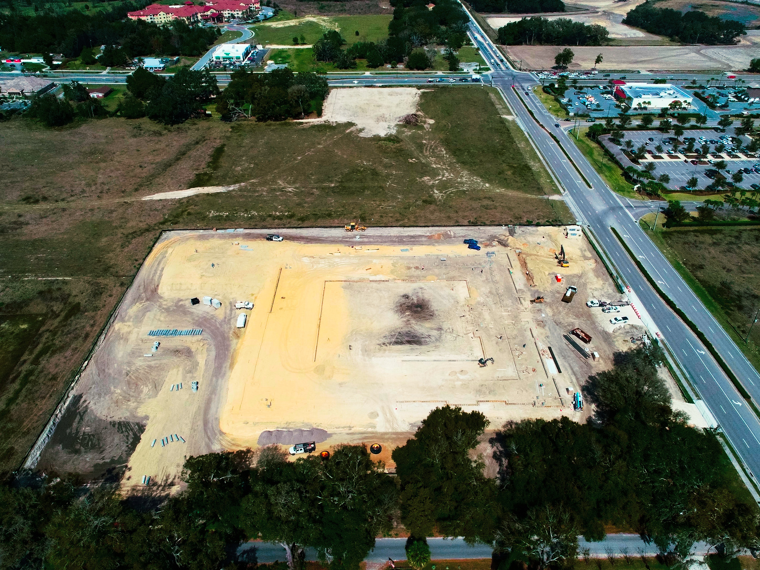
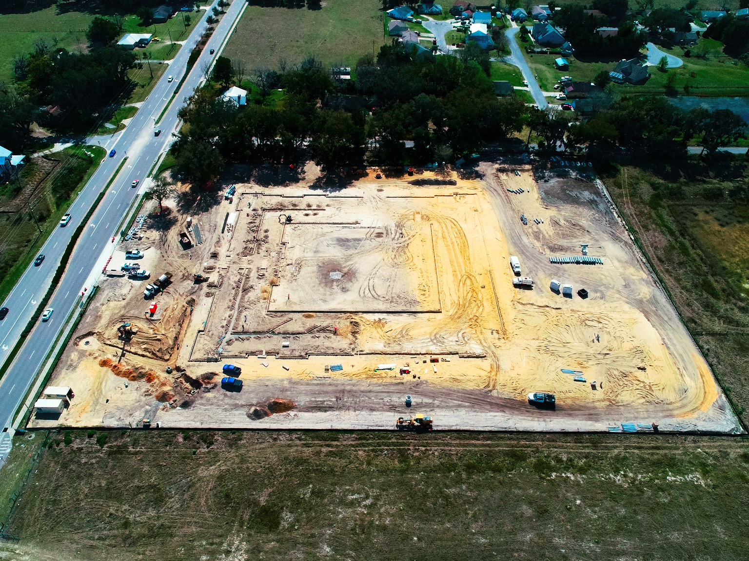
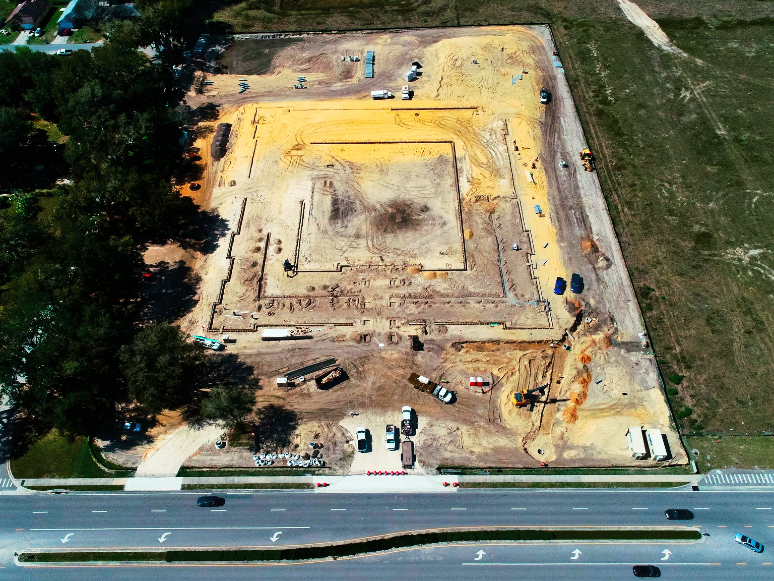
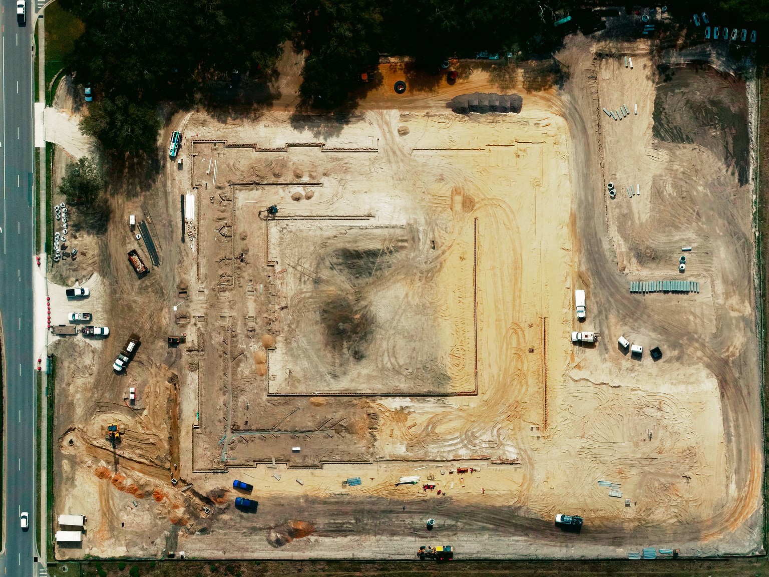
Construction Progress Monitoring
Why 107 Aviation?
Mitigate risk and lower cost.
Avoid expensive and
unnecessary site visits in
person by letting us capture
aerial footage for you whenever
needed. We offer monitoring
flights on a Weekly, Bi-Monthly,
Monthly, and Quarterly
schedule.
Use aerial monitoring to:
- Help with strategic pre site planning with aerial site views for proximity and staging
- Track building progress, asset condition, inventory, and movement on site regularly
- Programmed flight patterns using exact position and shot framing can be saved and repeated consistently for time lapse development progress
- Provide a final marketing video to promote your finished project on social media
- Customized 3D photogrammetry, stockpile reports, and mapping missions are available upon request
General Information
Construction Progress Monitoring
Standard Monitoring Package
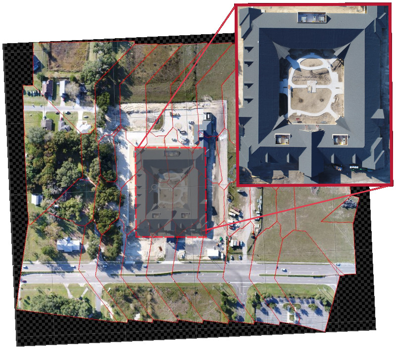
What is an orthophotomosaic?
Multiple straight down images stitched together to create one gigantic photo.When you should hire us over an expensive survey company?
- You want generally accurate measurements but do not need survey grade
- You don't want to pay a subscription cost for orthophotomosaics associated with other sites
- Our standard monitoring packages include overhead views of up to 10 acres
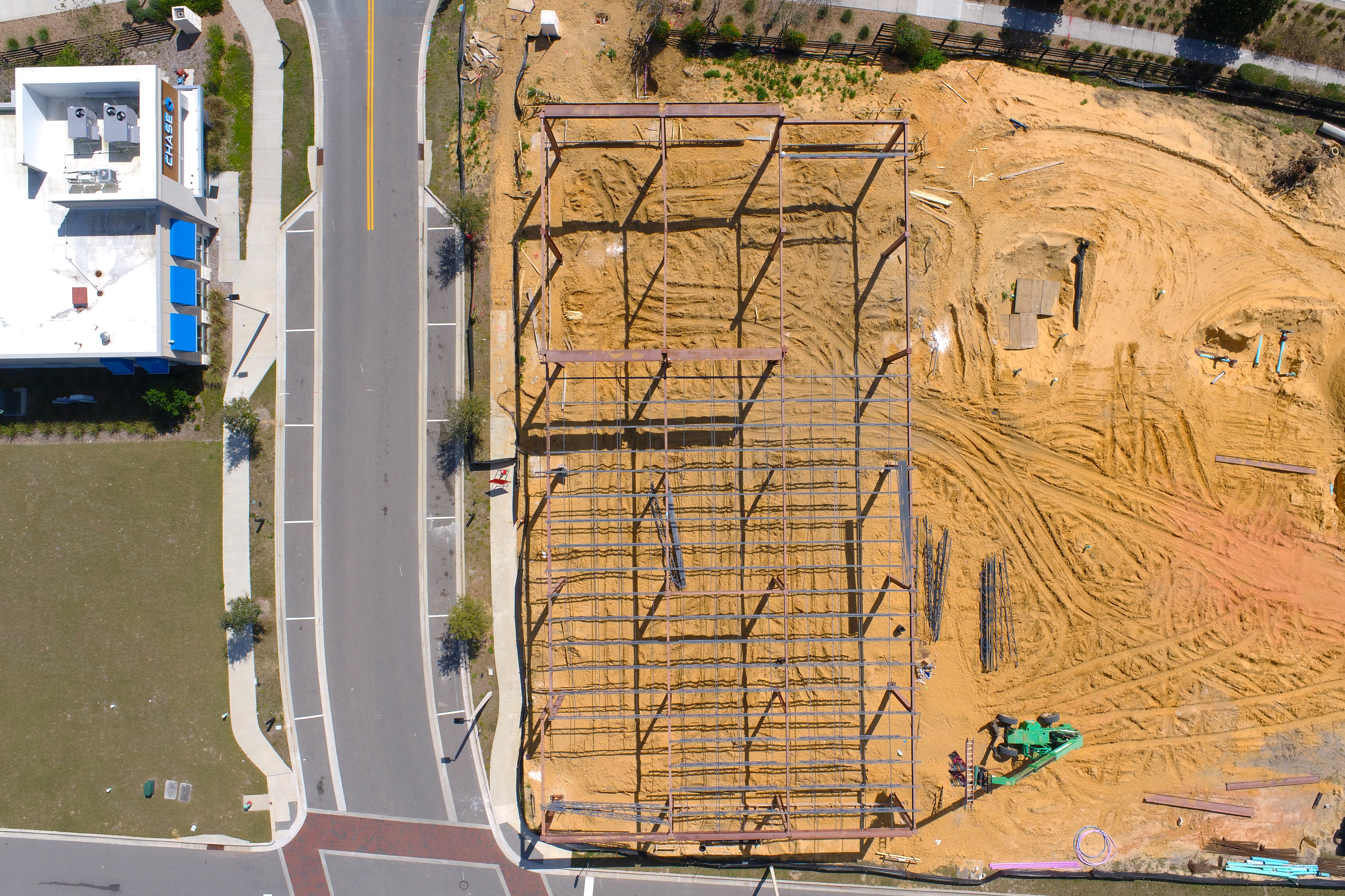
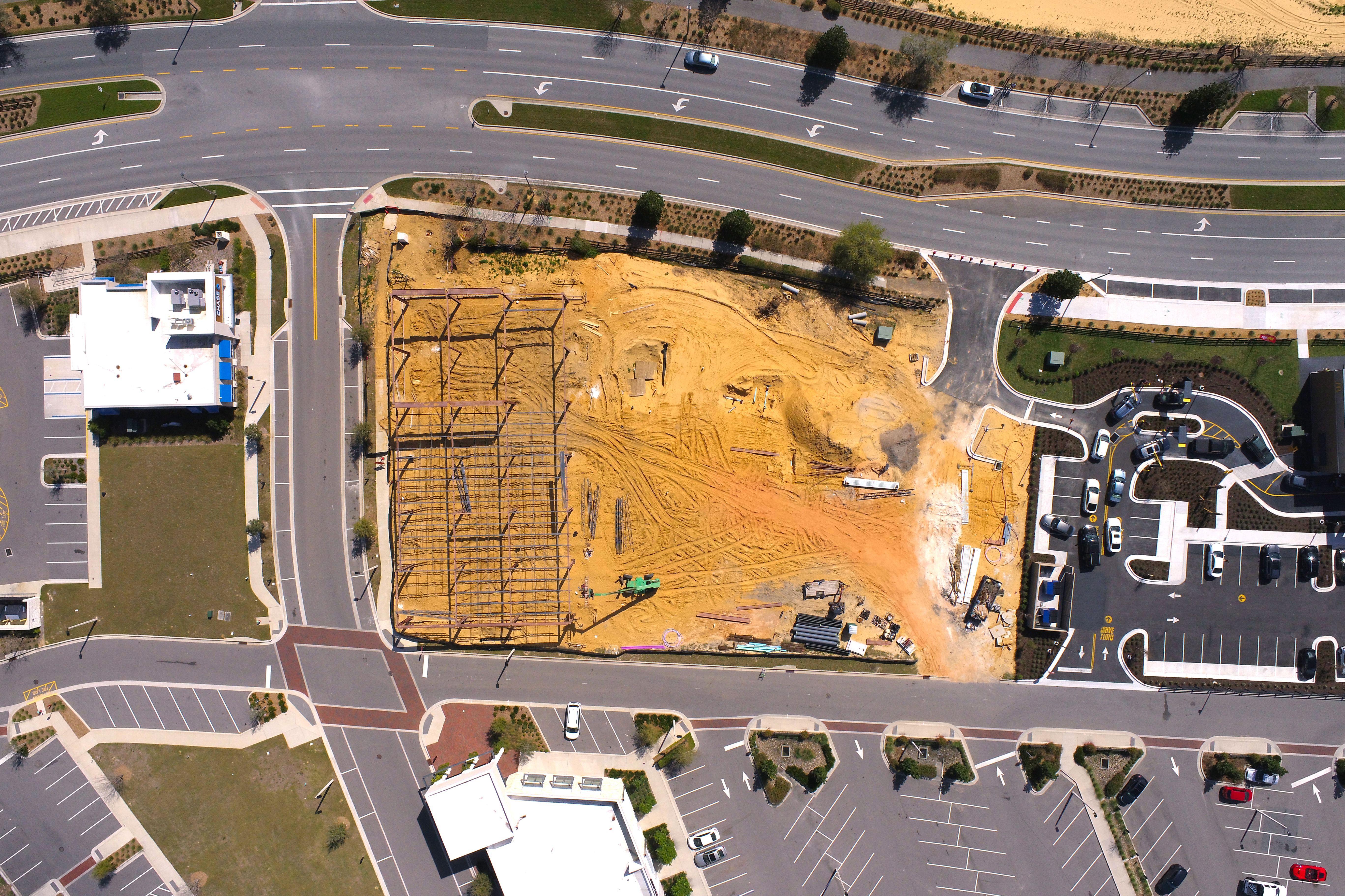
Stitched Image vs One Image


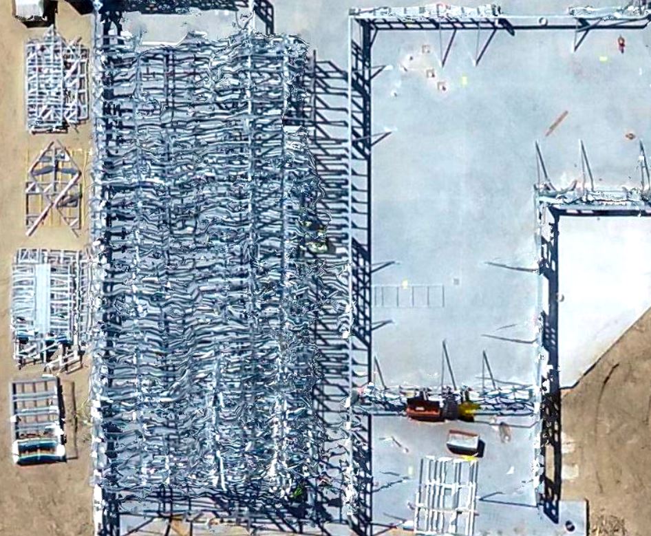
Automated Stitching vs Our Stitching?
Stitching issues
There is always going to be a bit of distortion when putting images together. Cloud based image processing (Automated Stitching) does a fairly good job, however, our in house software gives us more control over the process, allowing us to create better images.
Automated Stitching
Our Stitching
Samples
Sample deliverables available for your projects
- All
- North
- South
- East
- West
- Top Down
Weekly + Perimeter Video
$250 / week
- 5 photos
- up to 10 acres
- 1 Perimeter video
- 400 feet
- Extra fees may apply (FAA flight waiver, one time set up fee, etc.)
Monthly
$300 / month
- 5 photos
- Up to 10 acres
- 400 feet
- Extra fees may apply (FAA flight waiver, one time set up fee, etc.)
- 1 Perimeter video
Monthly + Perimeter Video
$350 / month
- 5 photos
- Up to 10 acres
- 1 Perimeter video
- 400 feet
- Extra fees may apply (FAA flight waiver, one time set up fee, etc.)
Marketing Video
$500 / one time
- End of project marketing video
- Extra fees may apply
Custom Data Acquisition
Starting at
$375 / one time
- Data acquisition for area and distance measurements, volumetric analysis, point cloud generation, etc.
- 107 Aviation is not a survey company and does not guarantee the accuracy or precision of any deliverable products. Any measurements provided are NOT considered survey grade and are NOT endorsed by a certified surveyor or professional engineer and should NOT be used as such without further consultation with a certified surveyor or professional engineer
Frequently Asked Questions
-
How does it work?
An initial site visit will include multiple photos at different angles. You select the most relevant shots moving forward. We will take it from there. We will visit the site at the designated interval and deliver the link to download them. We keep back ups just in case.
-
Am I locked into a contract?
No, our service agreement is simple. Either party may cancel at any time given a 1 month notice.
-
Can I adjust the flight schedule as needed?
Yes, we are happy to adjust to your requirements, as long as it doesn’t result in an additional flight within the prescribed contract schedule.
-
Do I need to be there?
No, as long as we have permission and a point of contact at the site, we are good.
-
Can we fly from offsite or do we need access?
While we would prefer to fly from within the premises, we can operate from outside of the property if requested.
-
Do you carry your own PPE?
We have our own reflective vests, hard hats, steel toed boots, and safety glasses.
-
How are the images received?
We will send you a link to the images on our cloud drive where you can view and download the deliverables. We also keep back ups that are archived on our local storage medium.
-
What is the turnaround time?
We do our best to process your shots overnight, but depending on our current workload, it might take an extra day or two.
-
Do you do interior shots? Can you fly indoors?
In some cases we can fly indoors, as long as the area is big enough and it is deemed safe, however, most interior shots can be easily accomplished using our ground camera. We are working on offering interior 360 products as well. Please let us know if you are interested.
-
Can you provide 360 images?
Want to look around the site at your own leisure. Maybe even step into a VR headset to see how everything is progressing in the safety of your own home. Then 360 is an option. Look up and down and side to side on your construction site.
-
Can you do aerial mapping or 3D modelling?
Yes, we recommend 30 or 45 degree angled photos for that. If you do need metrics we can also provide area and volume measurements.
Contact Us
Contact us now for a free quote and advice on your upcoming project
Subscribe: